options
tech stuff
site version: 2024.08.28.1
accepts WebM: true
4414692
score: 8
favorites: 5
comments: 2
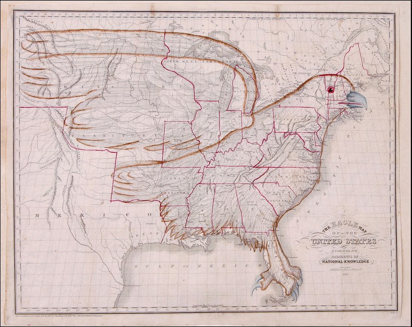
Map of the territory of the United States in 1833 (ignoring the claim on Oregon) with lines added to form the shape of an Eagle. This is "The Eagle Map of the United States" from a book entitled Rudiments of National Knowledge, Presented to the Youth of the United States, and to Enquiring Foreigners. By a Citizen of Pennsylvania published by E.L. Carey & A. Hart in Philadelphia, 1833. A teaching wall map.
4414691
score: 10
favorites: 5
comments: 1
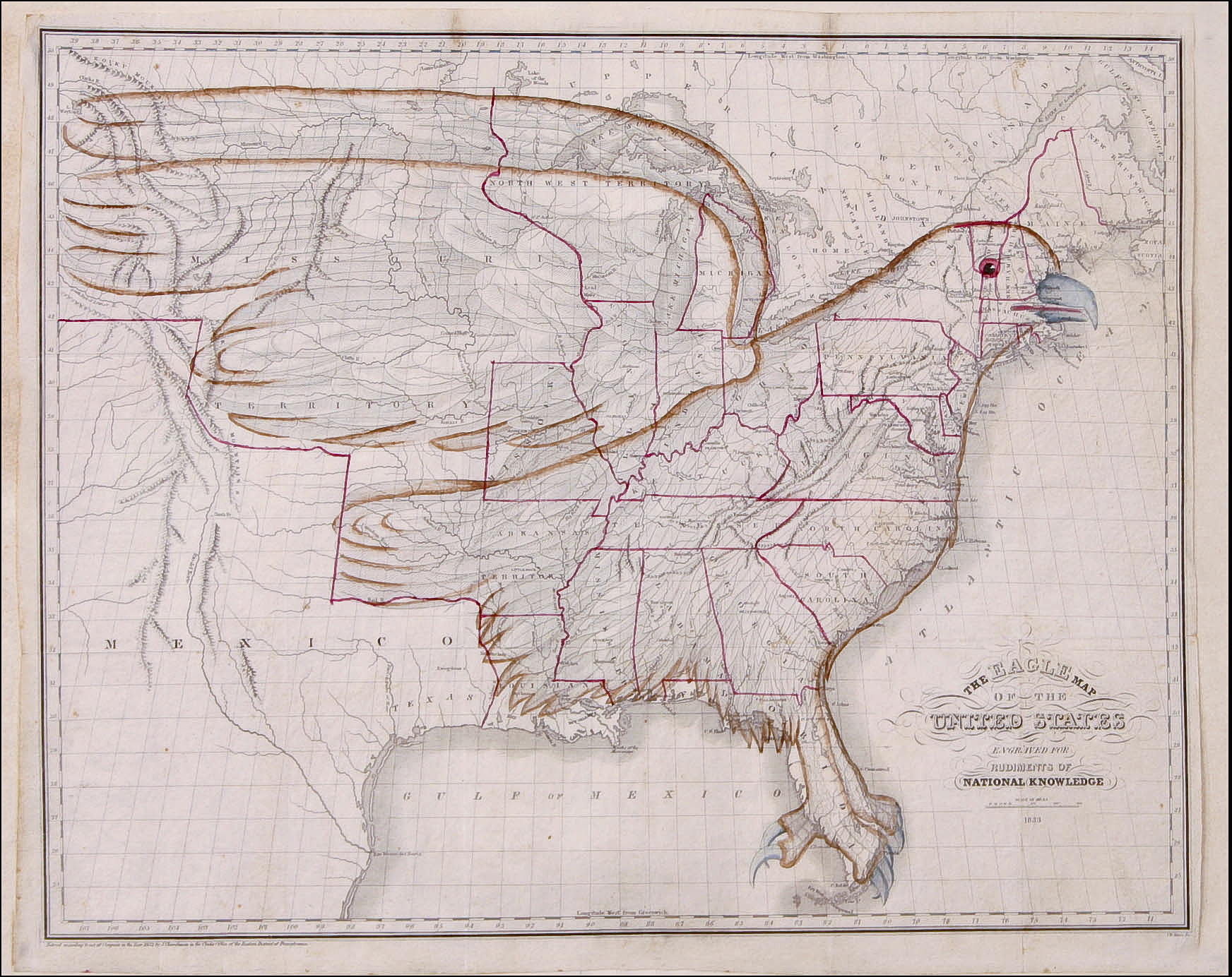
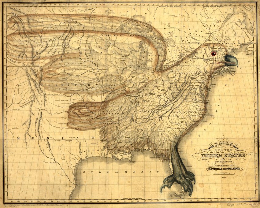
The eagle map of the United States
-  Relief shown pictorially.
-  Shows the image of an eagle superimposed on the United States.
-  "Entered according to act of Congress in the year 1832 by J. Churchman in the Clerk's Office of the Eastern District of Pennsylvania."
-  From Churchman's Rudiments of national knowledge. Philadelphia : E. L. Carey & A. Hart, 1833.
-  Available also through the Library of Congress Web site as a raster image.
-  Vault
-  Acquisitions control no. 91-42-b

3184022
score: 81
favorites: 109
comments: 40
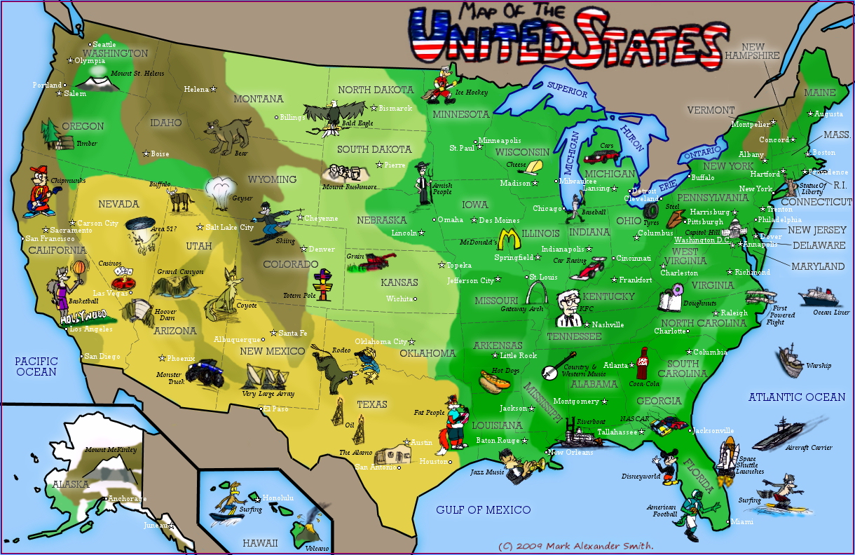
Artist's description:

Another cartoon map, this time of the United States. It's the most colourful one yet!

Sorry, but no cheesy charicature of President Obama I'm afraid! The map is crowded enough

1628769
score: 14
favorites: 13
comments: 0